Kapur Awarded Second Consecutive Top-Ranked Company in Milwaukee Business Journal’s Best Places to Work “Extra-Large” Category
News |
By Scott Hansen


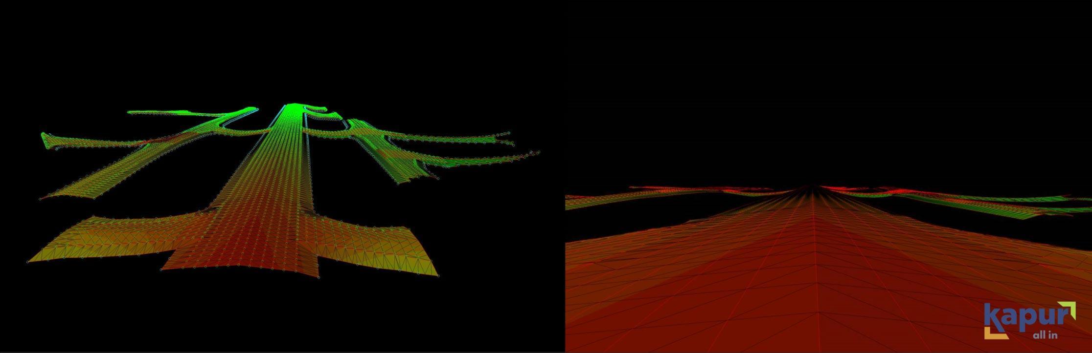
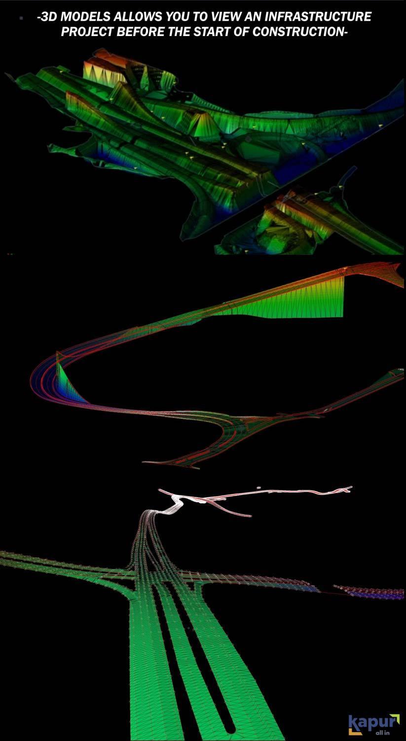
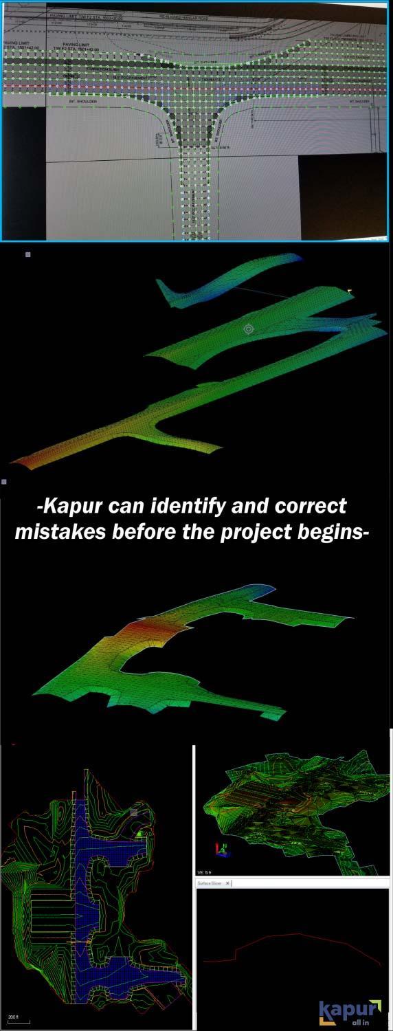
With the ever-evolving technology that is being utilized in the infrastructure industry, one of the most beneficial advancements in the last few years to Kapur’s team has been the development of 3D modeling. Since these technologies, Kapur uses these 3D programs for plans, specs, and crucial information to be combined into a singular file with full detail. By combining the information in this way, our entire team can have a more complete picture of how everything will conform in the three-dimensional world that we live in. Allowing our team to have the complete picture to view is beneficial. It allows our team to view projects before they begin, identify and correct errors faster, increase production time, have easily shareable files, a second set of eyes, efficient collaboration between teams, and quick feedback time.
What are the 3D models that Kapur builds?
Kapur’s 3D modelers will take a multiple two-dimension flat set of plans and create them into the three-dimensional space before any infrastructure project has even started. To do this, the modeler will bring all the proposed plans from the designers (paving grades, cross-sections, and typical sections; as well as wall, drainage, and bridge plans) and bring them together to create one working, all-inclusive 3D model. By putting all this information into one 3D model, it brings all the pieces to life clearly for all to see. It ensures everyone has efficient collaboration between teams, clients, and contractors involved with the project. This one single file may be used by all involved in building the infrastructure project.
Specific uses of 3D models
There are a growing number of ways that these 3D technologies are utilized by our clients. These 3D models all aid in making the building process more efficient and accurate. Being able to create and reference a three-dimensional model has a wide assortment of practical uses, listed below are a few examples.
GPS Machine Control – This type of 3D model is sent to GPS Rovers that can read the model and allow the field crews to see where grading is needed.
Survey Staking – Survey crews use this type of 3D model so they can accurately locate where stakes should be placed.
Stringless Paving – With this advancing technology becoming the preferred paving method, this has become especially useful. The stringless pavers are equipped with the technology to read the 3D models Kapur creates and identify where to precisely pave, all under the crew’s supervision and knowledge of the model.
Earthwork Quantities – This 3D technology can effectively compute volumes of the area and compare them with the proposed subgrades. By creating a singular, detailed model in the three-dimensional space, both modelers and contractors benefit and can work together with ease.
Benefits of 3D models
There are numerous benefits when using one of Kapur’s 3D models during an infrastructure project. Below is a list of benefits that can save time and cost to a project.
Why use 3D models?
Kapur continues to have an enthusiastic willingness to explore innovative technologies to benefit infrastructure projects, like the use of 3D modeling. These advancing technologies ensure that our models, layout, and earthwork are precise and accurate. It further allows us the ability to use countless software programs and hardware. Kapur modelers, creating the ability to look at a three-dimensional space before any work takes place allows for a new perspective on the data and allows for any revisions to be made with ease. By looking at the complete 3D picture, we are setting our Kapur team, our clients, contractors, and projects, up for success.